Danxia Mountain
1. Introduction
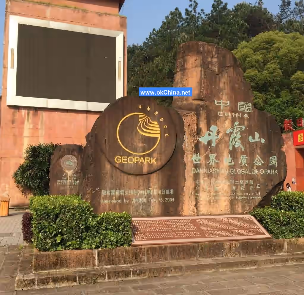
Danxia Mountain (China Red Stone Park) is located within Renhua County, Shaoguan City, Guangdong Province, between 113°36′25″ to 113°47′53″ east longitude and 24°51′48″ to 25°04′12″ north latitude. With a total area of 292 square kilometers, it is the largest scenic area in Guangdong Province, a scenic area primarily featuring Danxia landform landscapes, and a UNESCO World Natural Heritage site.
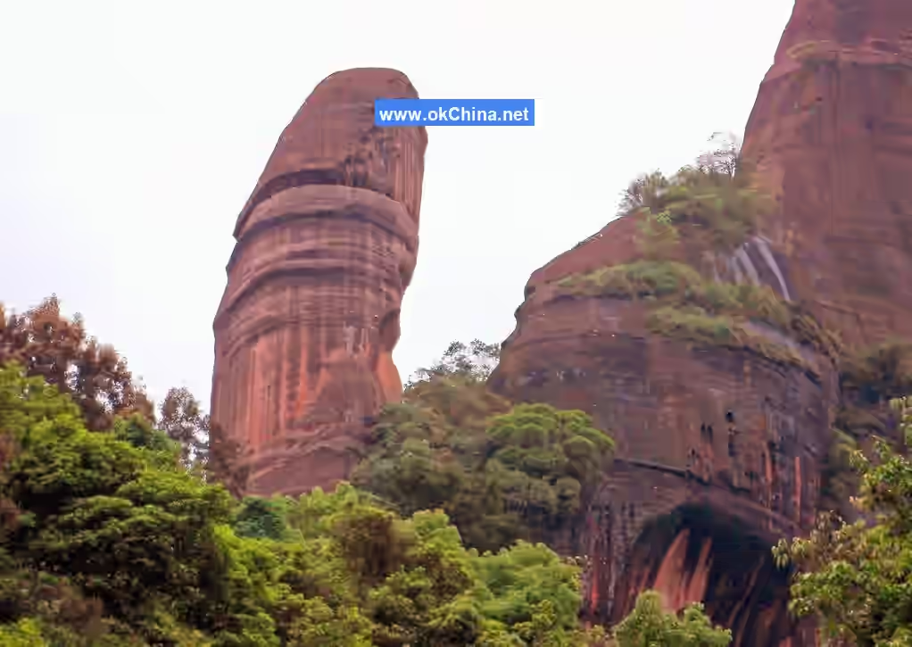
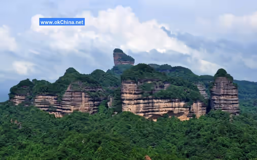
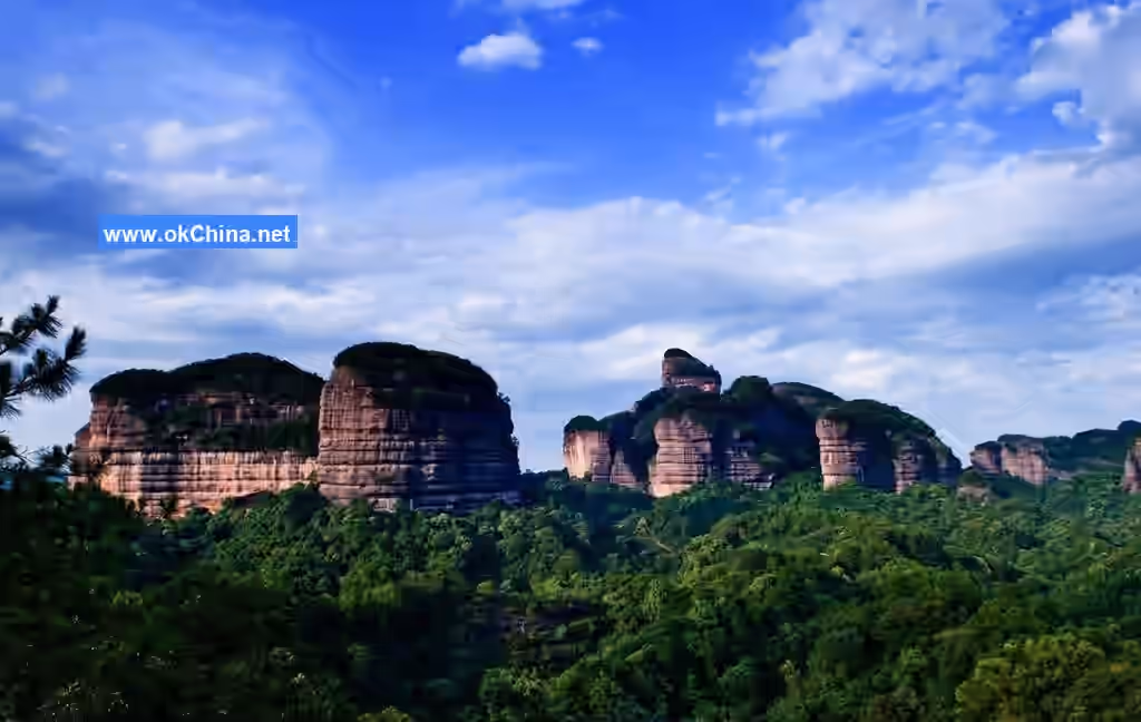
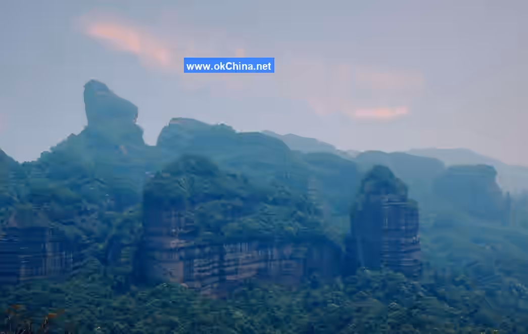
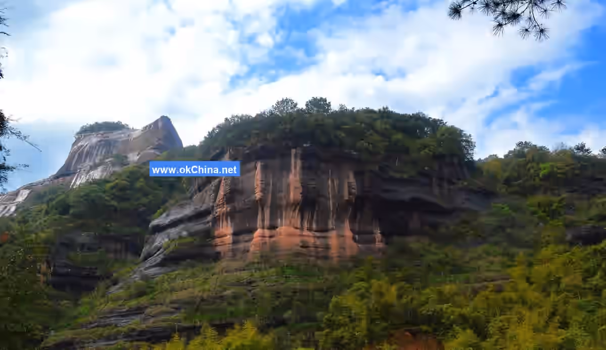
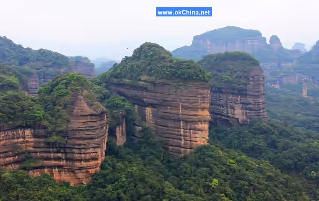
Danxia Mountain is the namesake of the global "Danxia landform." It consists of over 680 red conglomerate and sandstone rocks characterized by flat tops, steep cliffs, and gentle foothills, described as "red as cinnabar, radiant as bright clouds," with red cliff faces as its hallmark. Geological studies indicate that among the over 1,200 Danxia landforms discovered worldwide, this area represents the most concentrated distribution of the most typical, complete, and richly varied Danxia landforms.
Between 140 million and 70 million years ago, the Danxia Mountain area was a large inland basin. Influenced by the Himalayan orogeny, the surrounding mountains uplifted intensely, and the basin received vast amounts of clastic deposits, forming a massive red stratum. After 70 million years ago, the crust rose and gradually underwent erosion. Since about 6 million years ago, the basin experienced multiple intermittent uplifts, averaging approximately 1 meter per 10,000 years. Concurrently, fluvial downcutting and erosion dissected the Danxia red beds into a cluster of red mountains, forming the Danxia Mountain scenic area.
Within Danxia Mountain, there are over 680 stone peaks, stone walls, stone pillars, and natural bridges. Research on Danxia Mountain concerning its stratigraphy, structure, geomorphological expression, developmental processes, driving forces, natural environment, and ecological evolution is the most detailed and in-depth among Danxia landform areas in China. It has become a research base for Danxia landforms both nationally and globally, as well as a base for popular science education and teaching internships.
2. Geographical Environment
2.1 Geographical Location
The Danxia Mountain Scenic Area is located in the northeastern suburbs of Shaoguan City, Guangdong, China. Its geographical coordinates range from 113°36′ to 113°47′ east longitude and 24°51′ to 25°4′ north latitude. The scenic area covers 292 km², with a total controlled area of 373 km². The environmental protection zone extends to the peripheral roads, bounded roughly by Provincial Highway S246 (new route) and the Xinshaoren Highway (planned) to the north and west, and by National Highways 106 and 323 to the northeast, east, and southeast.
2.2 Climate Conditions
Danxia Mountain is situated on the southern slope of the Nanling Mountains, at the southern edge of the subtropical zone. It features a humid subtropical monsoon climate with transitional characteristics from the central to the southern subtropics.
The annual average temperature at Danxia Mountain is 19.7°C, with an extreme minimum of -5.4°C and an extreme maximum of 40.9°C. The maximum monthly average diurnal temperature range is 18.8°C. The hottest month, July, averages 28.3°C, while the coldest month, January, averages 9.5°C. The average maximum and minimum temperatures are typically higher in autumn than in spring.
Danxia Mountain receives an average annual sunshine duration of 1,721 hours, with solar radiation of 107.2 kcal/cm². The average daily sunshine duration is 4.7 hours, being more abundant from July to September and less from February to April.
The average annual precipitation is 1,715 mm over 172 rainy days. Precipitation from March to August accounts for about 75% of the annual total, with April to June being the most concentrated period, contributing about 48% of the annual rainfall.
2.3 Topography and Geomorphology
The geomorphology of the Danxia Mountain Scenic Area is composed of over 680 red conglomerate and sandstone rocks with flat tops, steep cliffs, and gentle foothills, characterized by red cliff faces, known as the Danxia landform. This area is the world's most concentrated distribution of the most typical, complete, richly varied, and scenically beautiful Danxia landforms. The Danxia Mountain area was a large inland basin. Influenced by the Himalayan orogeny, the surrounding mountains uplifted intensely, and the basin received vast amounts of clastic deposits, forming a massive red stratum, belonging to the red bed landform. The red sandstone on the mountains, through long-term weathering and fluvial erosion, has formed isolated peaks and steep, bizarre rocks. The thick red sandstone and conglomerate beds are dissected along vertical joints.
2.4 Climatic Features
The Danxia Mountain Scenic Area is located on the southern slope of the Nanling Mountains, at the southern edge of the subtropical zone. It features a humid subtropical monsoon climate with transitional characteristics from the central to the southern subtropics. Summers are long and winters short. Spring and summer are cloudy and rainy, while autumn and winter have less precipitation, with autumn being clear and crisp. The scenic area lies within the monsoon zone. Being relatively far from the sea, it is rarely directly damaged by typhoons, mostly experiencing only the influence of their peripheral low-pressure circulations. However, typhoons significantly impact autumn rainfall in Danxia Mountain; without their influence, there would be little rain and reduced water resource replenishment. The annual average temperature is 19.7°C, with average maximum and minimum temperatures typically higher in autumn than in spring. The average annual precipitation is 1,715 mm over 172 rainy days.
2.5 Tectonic Background
Between 140 million and 70 million years ago, the Danxia Mountain area was a large inland basin. Influenced by the Himalayan orogeny, the surrounding mountains uplifted intensely, and the basin received vast amounts of clastic deposits, forming a massive red stratum. Around 70 million years ago, the crust rose and gradually underwent erosion. Since about 6 million years ago, the basin experienced multiple intermittent uplifts, averaging approximately 1 meter per 10,000 years. Concurrently, fluvial downcutting and erosion dissected the Danxia red beds into a cluster of red mountains, forming the Danxia Mountain area.
2.6 Developmental Model
Danxia Mountain developed within a structural basin in the central part of the Nanling fold belt. It exhibits diversity in individual landform types and uniqueness in landscape features. It is the namesake of the Chinese Danxia landform and the type locality for its main categories and fundamental characteristics. It represents a mature to late-mature clustered peak cluster and peak forest type of Danxia landform. Among the series of nominated sites, it contains the highest proportion of tropical species and the most prominent ravine rainforest characteristics. It is a model area for studying the Danxia biological lineage and the "island effect" and "heat island effect" associated with Danxia landforms.
Within Danxia Mountain, there are over 680 stone peaks, stone walls, stone pillars, and natural bridges. Research on Danxia Mountain concerning its stratigraphy, structure, geomorphological expression, developmental processes, driving forces, natural environment, and ecological evolution is the most detailed and in-depth among Danxia landform areas in China. It has become a research base for Danxia landforms both nationally and globally, as well as a base for popular science education and teaching internships.
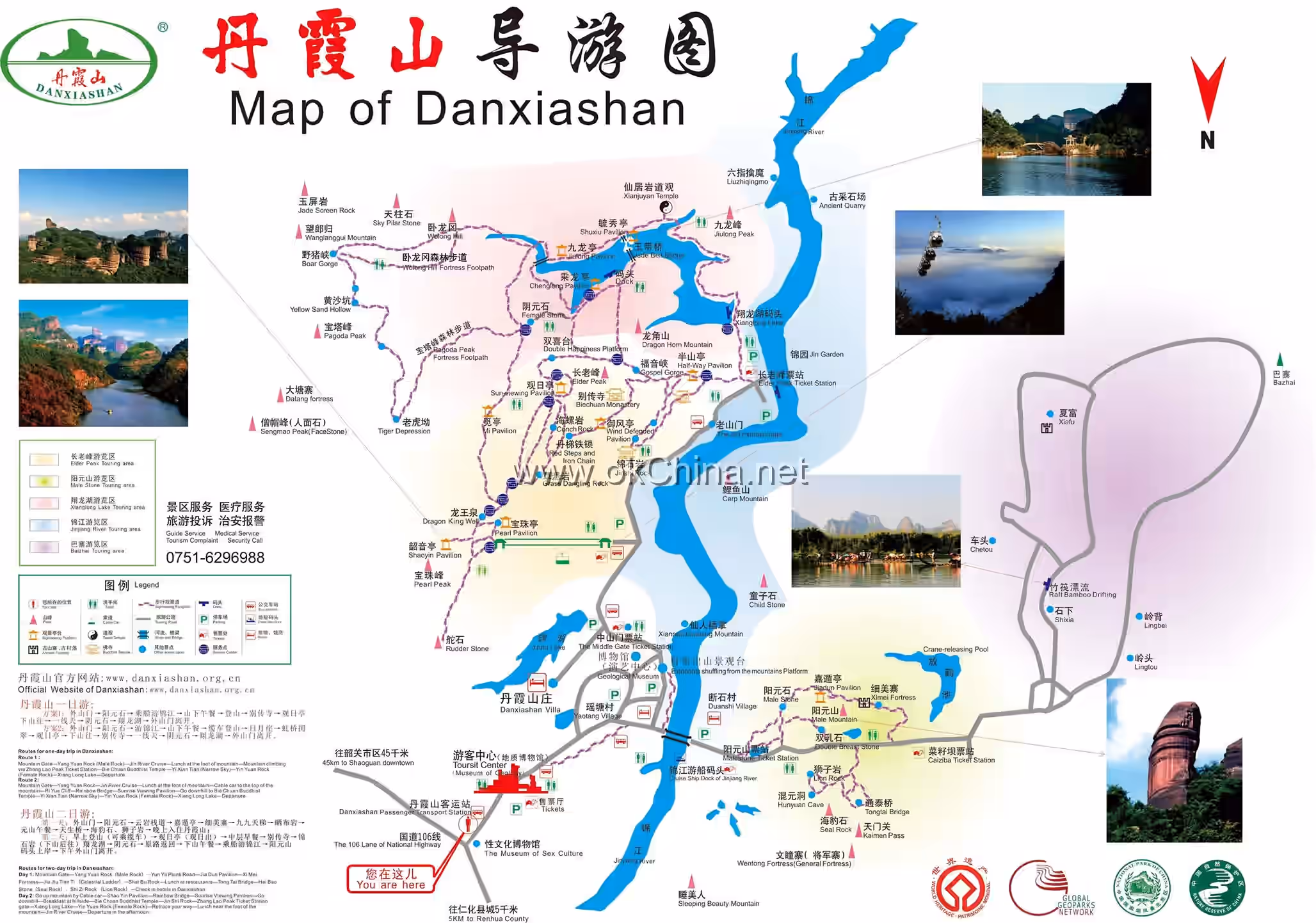
3. Main Scenic Areas
3.1 Geological Museum (Science Popularization Audio-Visual Hall)
The Geological Museum (Science Popularization Audio-Visual Hall) is located in the northern part of Guangdong Danxia Mountain National Geopark, southwest of Yaotang Village. It covers a total area of 6,000 square meters with a total floor area of 3,300 square meters across two floors. It consists of a multimedia exhibition hall, landscape resources exhibition hall, geological genesis exhibition hall, geomorphological achievements exhibition hall, biodiversity exhibition hall, Danxia culture exhibition hall, and Danxia scientific research achievements exhibition hall.
3.2 Zhanglao Peak (Elder Peak) Tour Area
The Zhanglao Peak Tour Area is located in the eastern part of Guangdong Danxia Mountain National Geopark and is divided into three scenic layers: lower, middle, and upper. The lower layer is the Jinshiyan (Brocade Stone Cave) scenic layer, featuring over 10 geological heritage sites including the Jinshiyan Grotto Temple, Mengjue Pass (Awakening from Dream Pass), Tongtian Gorge, Baizhang Gorge, Mawei Spring (Horsetail Spring), and the most typical red cliff faces. The middle layer is the Biechuan Temple viewing layer, with attractions such as Biechuan Temple, Yuanyang Trees (Mandarin Duck Trees), Yixiantian (Thread of Sky), and Shuangchi Bihe (Twin Ponds with Green Lotus). Climbing the iron-chain ladder leads to the top layer, where one can enjoy a panoramic view of the entire Danxia Mountain area, as well as sights like Sengmao Peak (Monk's Cap Peak), Tongzi Bai Guanyin (Child Worshipping Guanyin), and Lazhu Peak (Candle Peak).
3.2.1 Enveloped in Clouds and Mist
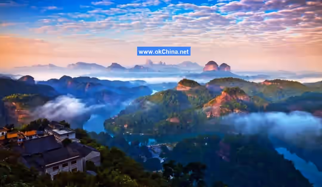
Danxia Mountain offers different scenery for visitors in all four seasons, regardless of sunny or rainy weather, morning or evening. In the morning, one can witness the spectacle of sunrise and a vast sea of clouds; in the evening, one can enjoy the brilliant sunset and tranquil nightscape. On rainy days, gazing into the distance broadens one's mind and dispels all worries. As for the wonders of the scenery in spring, summer, autumn, and winter, only those who experience it firsthand can truly appreciate them.
3.2.2 Mengjue Pass (Awakening from Dream Pass)
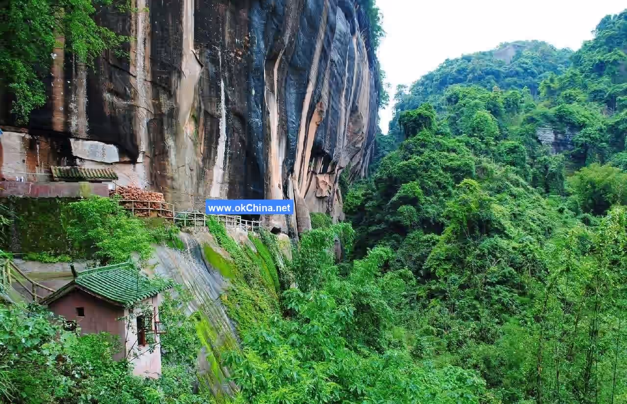
Upon entering the Danxia Mountain Scenic Area, visitors are greeted by the Danxia Gate Tower, resplendent in gold and green. The archway is inscribed with the three large characters "丹霞山" (Danxia Mountain) by a former Vice Chairman of the National People's Congress. Following the uphill path to the Mid-Hill Pavilion, turning left towards Jinshiyan, one first encounters a stone cave. It connects to steep cliffs above and overlooks a deep ravine below, forming a strategically important location like a pass. During the Northern Song Dynasty, the Buddhist layman Fayun, following a secluded path, arrived here. Enchanted by the scenery, he stopped to rest and exclaimed, "Half my life has passed in a dream; today I finally feel clarity and emptiness." Later, this place was named "Mengjue Pass" (Awakening from Dream Pass). Although this stone cave is only about ten feet wide, it is extremely neat, shaped like a Buddhist niche. Sitting atop it, one can admire the Jin River below and the cloud-touching rocks above.
3.2.3 Yunya Ladder (Cloud Cliff Ladder)
About 1,000 meters ahead from Youdong Tongtian (Secluded Cave Reaching Heaven), a cliff stands towering against the sky. The cliff is split from top to bottom by a narrow crack, 200 meters long, over 40 meters high, and only about 1 meter wide, with the narrowest point merely 0.7 meters. This forms a perilous small path from Youdong Tongtian to Jinshiyan. Walking through it, one feels the sheer cliffs rising on both sides, seemingly about to topple. Looking up at the sky, only a thin line of heaven is visible. Shrubs and trees growing in the crevices on both sides interlace their branches and leaves. Occasionally, rock eagles dart by swift as meteors, adding to the mysterious atmosphere of the place.#### 3.2.4 The Sky-Reaching Secluded Cave
Ascending along the main mountain path and turning left, one encounters a naturally weathered and eroded cave inscribed with the characters "幽洞通天" (Sky-Reaching Secluded Cave). This is a cylindrical horizontal passage, with a height of only 0.9 meters inside, formed by water erosion of the rock and the accumulation of collapsed stones. The cave is less than 10 meters long, remaining warm in winter and cool in summer. The other end of the passage connects to a vertical sky-reaching cave, over 40 meters high, leading directly to the middle-level scenic area. Surrounded by steep cliffs, ancient vines and long creepers hang down. Due to air convection, wind often arises within the cave.
3.2.5 A Sliver of Sky (Hundred-Zhang Gorge)
The gorge stretches over 200 meters in length, stands more than 40 meters high, and is about one meter wide, with the narrowest point being only 0.7 meters. To the right is the Self-Sacrifice Cliff, traditionally believed to be the place where the Wood-Burning Buddha sacrificed himself to attain Buddhahood. A rock at the top of the gorge is said to be the transformed remains of the Wood-Burning Buddha after his self-sacrifice to save others. Passing through here, visitors are flanked by towering cliffs that seem on the verge of collapsing. Looking up at the sky, only a sliver remains visible, with the closest points appearing leapable. The interwoven branches and leaves of shrubs in the crevices on both sides add to the mysterious atmosphere. Several films, including Independent Battalion, From Slave to General, and Lightning Action, have shot thrilling scenes here.
3.2.6 Brocade Stone Cliff
The Brocade Stone Cliff connects to the Conch Cliff above and overlooks the Brocade River below. Composed of the Thousand Saints Rock, Patriarch Rock, Subduing Tiger Rock, and Dragon King Rock, it forms a structure "resembling a grand hall, deep and cavernous." The cliff is named "Brocade Stone Cliff" because its inner stone walls display a myriad of interwoven colors that change with the seasons.
3.2.7 Biechuan Temple
The name "Biechuan" (Separate Transmission) derives from the meaning of "mind-to-mind transmission apart from the scriptures," referencing Bodhidharma's arrival from the west, which emphasized direct mind transmission without reliance on written words. In the 18th year of the Shunzhi reign (1661), the monk Dangui led his disciples to Danxia Mountain to establish a Buddhist site and promote Dharma. Seeing the surrounding peaks standing in rows like descendants bowing in reverence, with a river winding like a belt flowing westward before the site—resembling a Dharma King seated on a throne—he founded the temple here, marking the beginning of Biechuan Temple.
3.2.8 Dan Ladder and Iron Chains
This is the most perilous spot on the entire mountain. It serves as the passage from the front mountain to the summit. Originally inaccessible, stone steps were later carved by human effort, supplemented with iron chains on both sides, allowing visitors to ascend to the peak and enjoy the boundless scenery. Climbing the "Dan Ladder" is an extremely steep ascent, almost like scaling a wall. With open space on both sides and nothing to hold onto, the thousand-zhang crimson cliffs plunge straight down to the ravine bottom, inspiring awe and dizziness. It is truly an adventure that tests one's courage, requiring careful, steady steps.
3.2.9 Sunrise Viewing from Elder Peak
At dawn, standing atop Elder Peak and gazing into the distance, one can watch the rising sun, like a golden wheel or fiery orb, spinning up and down, floating and sinking, repeating two or three times before slowly ascending. The sunrise at Danxia, framed and accentuated by the surrounding peaks, is uniquely magnificent, "its grandeur no less than Mount Tai's, its wondrous beauty not yielding to Mount Huangshan's."
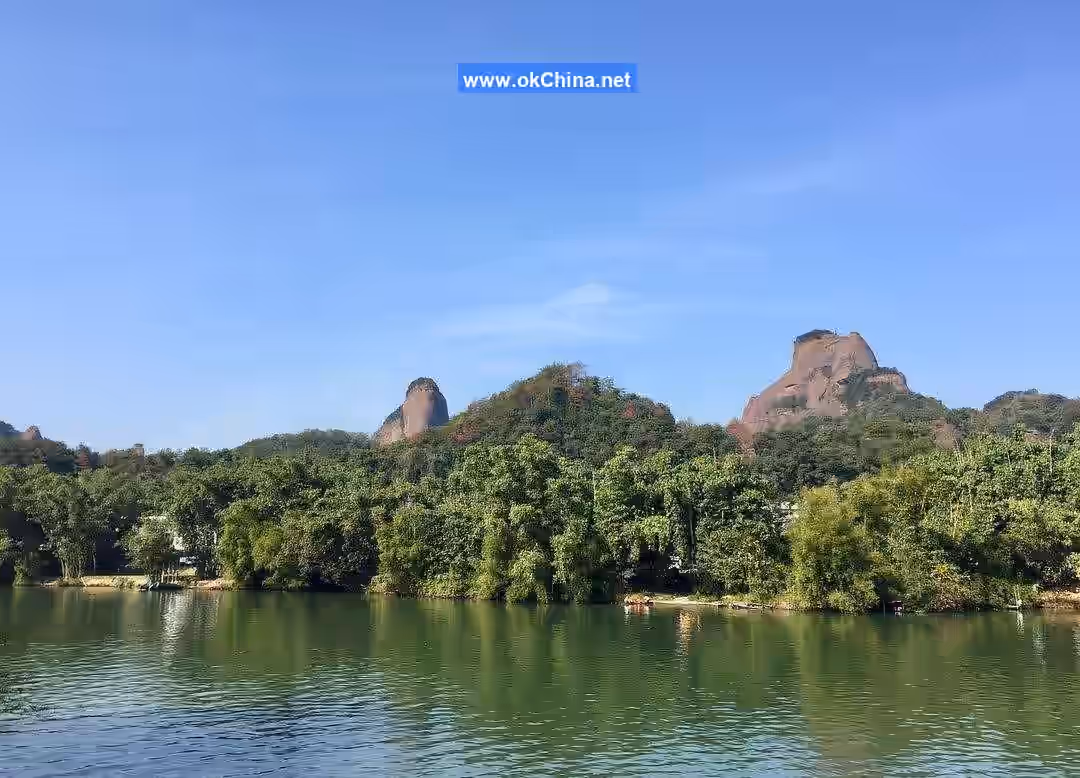
3.3 Xianglong Lake Scenic Area
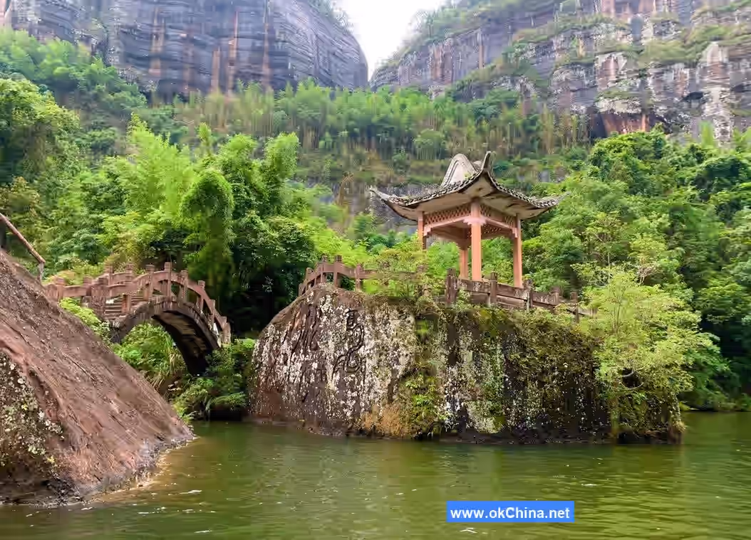
Located in the southern valley of Guangdong Danxia Mountain National Geopark, the Xianglong Lake Scenic Area is named for its lake outline, which resembles a soaring dragon. Along the lake are numerous geological sites and natural landscapes, including Dragon Whisker Ravine, Nine Dragon Peak, Immortal's Dwelling Rock, Mist-Hidden Rock, Double Dragon Wall, Riding Dragon Platform, Praying Dragon Platform, Jade Belt Bridge, and Yuxiu Pavilion.
3.3.1 Riding Dragon Platform
This mountain is precisely situated on the dragon's back, hence the name Riding Dragon Platform. On the cliff slope of the platform, there is a pattern of black and green resembling cloud motifs, known as the Cloud Pattern Wall. Upon closer inspection, it also resembles two dragons: a larger one above facing west and a smaller one below facing east, its head touching the chest of the larger dragon, as if both are riding the clouds upward. Therefore, it is also called the Cloud Dragon Wall.
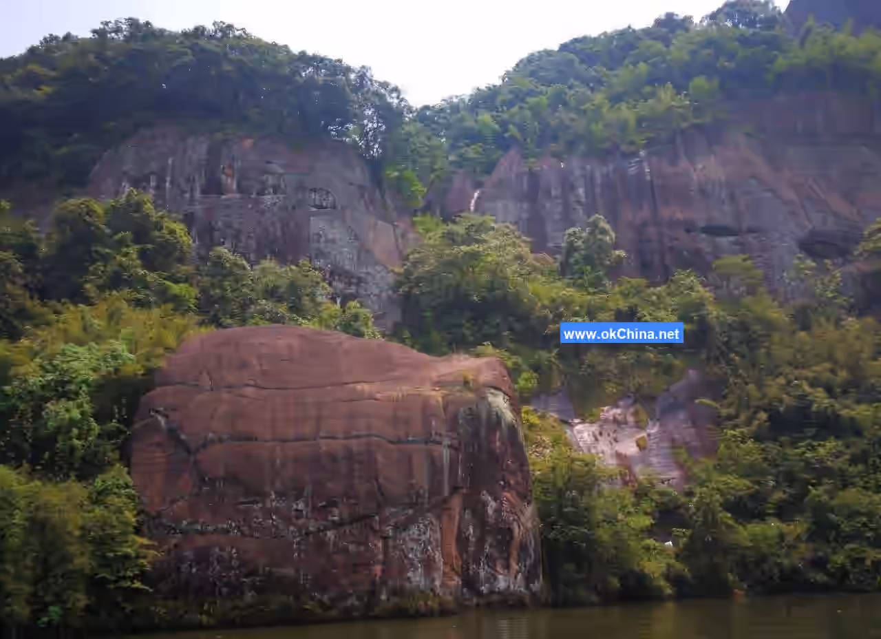
3.3.2 Two Dragons Playing with a Pearl
This is a cliffside stone carving based on Han Dynasty dragon imagery, depicting two dragons playing with a pearl. Measuring 28 meters long and 8 meters high, it is vividly lifelike. In the evolution of dragon depictions, the Han Dynasty dragon is considered the most vigorous. Though its lines are simple and bold, they lack any sense of artificiality.
3.3.3 Xianju Rock Taoist Temple
Xianju Rock Taoist Temple is the place where Celestial Master Zhang resided during his southern travels. Later generations built a temple here and offered incense in commemoration of Celestial Master Zhang's virtue in subduing the white tiger and saving the blue dragon. It is said there were originally three temple halls, five monastic rooms, and a pond, the foundations of which are preserved to this day. Xianju Rock faces northwest, corresponding to the Qian position in the Later Heaven Eight Trigrams. To its left front is Nine Dragon Peak; it is backed by the sheer cliff of Bagua Summit and faces the Banana Gully valley in front. The environment is secluded and tranquil, untouched by worldly dust. The main hall is majestically perched, commanding an imposing presence. Practicing cultivation here is said to allow one to distance oneself from worldly distractions and attain enlightenment sooner. Banana Gully is also known as True Immortal Valley. The path is lined with strange rocks and unique caves, especially a grove of banana trees in front of a cave, said to have been planted by ancient Taoist priests. The banana grove lies directly beneath the cliff, where rain drifts down from the cliff top year-round, creating a natural wonder. The sound of rain on banana leaves offers a distinctive Lingnan charm.
3.4 Jinjiang Scenic Area
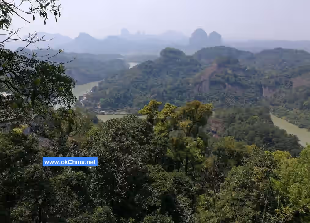
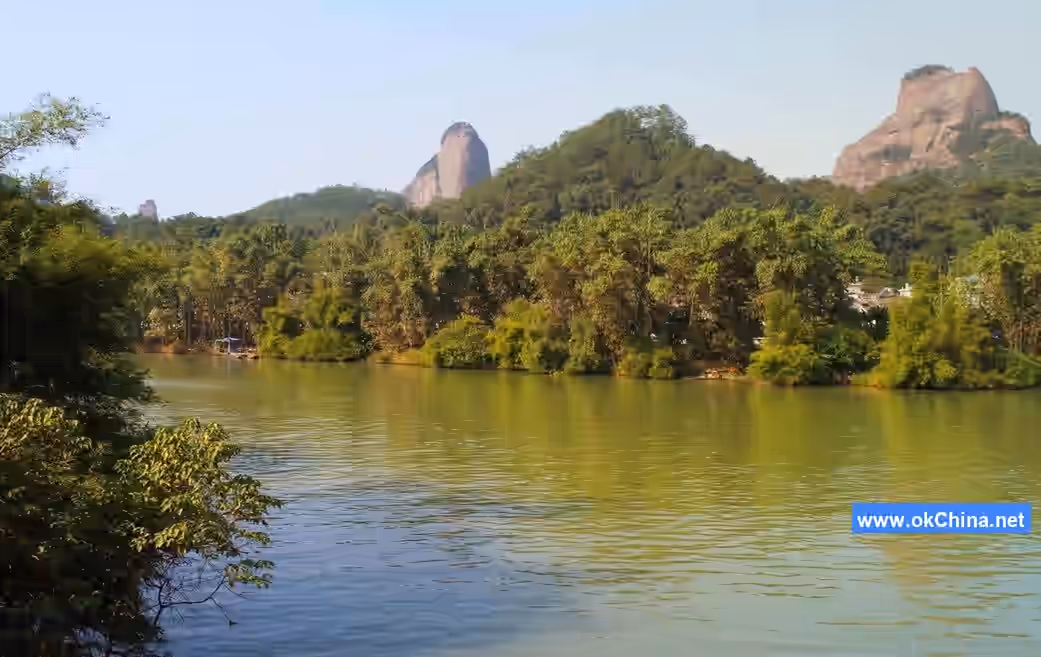
The Jinjiang River winds through the Danxia Mountain range from north to south, meandering for 36 kilometers within the Guangdong Danxia Mountain National Geopark. The upstream section has been developed into the Waterborne Danxia boat tour area. Taking a boat ride, visitors can view attractions along the way such as the Elephant Herd Crossing the River, Crimson Cliffs and Danxia, Golden Turtle Paying Homage, Carp Leaping over the Dragon Gate, Immortal's Palm Print, Teapot Peak, Guanyin Presenting a Son, and Sisters Peak. The downstream section is the bamboo raft scenic area, where visitors can enjoy sights like Soaring Dragon, Guanyin Rock, and Conch Mountain.
3.4.1 Jade Palace on a Fairy Mountain
On the left peak along the Jinjiang River stands a pavilion called the Viewing Pavilion. Ascending the pavilion via stone steps, one can take in the surrounding scenery. Looking ahead, one sees Sisters Peak, Thumb Peak, and Teapot Peak. Teapot Peak remarkably resembles a teapot, complete with a lid and spout, though it lacks a handle. The Swallow Rock and Flat Top in front of and behind Teapot Peak resemble a tea table and teacup, forming an amusing set with the Teapot Mountain. Looking to the left, one sees the "Heavenward Dragon." In the far distance stands a peak shaped like the Bodhisattva Guanyin. In front of Guanyin Rock are two smaller stone peaks, resembling a golden boy and jade girl, creating the scene of "Children Paying Homage to Guanyin."
3.4.2 Twin Ponds with Green Lotuses
Located to the right of the middle-level scenic area, beneath the former Zhengqi Pavilion, Twin Ponds with Green Lotuses features a massive rock over three meters high, shaped like a platform. Two stone ponds, one large and one small, were carved into this platform, resembling two bright mirrors. Hence, this spot was also once called "Twin Mirror Ponds."
4. Cultural Resources
4.1 Historical Development
Sui and Tang Dynasties: Danxia Mountain was already a scenic resort in Lingnan, with monks and nuns entering the mountain to manage and build Buddhist temples.
Northern Song Dynasty, Emperor Huizong's Chongning Era (1102-1106 AD): The lay Buddhist Fayun wandered to Danxia's Mengjue Pass. Seeing the wondrous caves and magnificent scenery, with rocks "colored like rich cinnabar, brilliant as bright clouds," he suddenly attained enlightenment, exclaiming, "Half my life has been spent in a dream; only today do I perceive clarity and emptiness." He then inscribed "Mengjue Pass" (Awakening from Dream Pass) and built 18 temple halls here, enshrining Guanyin Bodhisattva.
Late Ming Dynasty, Chongzhen Era (1644 AD): Li Yongmao, the governor of Ganzhou in Jiangxi, failed in his resistance against the Qing and retreated with his family to Danxia Mountain's "Elder Village," building dwellings, clearing fields, and gathering friends. His younger brother, Li Chongmao, later donated the mountain to a temple.
First Year of Qing Kangxi Reign (1662 AD): Chan Master Dangui from Guangzhou's Haichuang Temple came to Danxia Mountain to establish a Buddhist site and build Biechuan Temple. He successively constructed the Mahavira Hall, Maitreya Hall, Guanyin Pavilion, Sutra Repository, Abbot's Building, meditation rooms, guest halls, etc., creating a sizable mid-mountain monastery. Taking the term "Biechuan" from the Chan Buddhist teaching of "not establishing words, transmission outside the teachings, directly pointing to the human mind, seeing one's nature and becoming a Buddha," he named the temple "Biechuan Chan Temple."
21st Year of Qing Kangxi Reign (1683 AD): Another monk from Guangzhou's Haichuang Temple, Gu Jian, built nunneries at Danxia Mountain's Ban Village and Hongyan, and in the 50th year of Kangxi (1714 AD), he restored the statues of the Eighteen Arhats. Incense offerings at Danxia Mountain grew increasingly prosperous, with continuous pilgrimage activities.
41st Year of Qing Qianlong Reign (1776 AD): Li Huang, an official from Nanshao, visited Danxia and discovered Chan Master Dangui's manuscript Collected Works of the Partial Practice Hall in Biechuan Temple's sutra repository, which was suspected of containing anti-Qing sentiments. He presented it to Emperor Gaozong (Qianlong), leading to widespread slaughter of monks and the first major calamity for Biechuan Temple.
14th Year of the Republic of China (1925 AD): Nationalist army forces shelled across the Jinjiang River at over a hundred bandits led by Huang Yaoxiang. Fleeing bandits looted all the precious ritual objects from Biechuan Temple, inflicting a second disaster upon it.
15th Year of the Republic of China (1926 AD): Amid frequent domestic warfare and extreme local disorder, Renhua County Middle School relocated to Biechuan Temple to avoid calamity. A careless fire burned the mountain, reducing large structures like the Mahavira Hall and Weituo Hall to ashes. Biechuan Temple suffered its third catastrophe.
23rd Year of the Republic of China (1934 AD): Li Hanhun, the Pacification Commissioner of Northwestern Guangdong, led troops stationed in Shaoguan and oversaw the restoration of Danxia Retreat and Danxia Lower Monastery, composing Record of Restoring Danxia.
1963: Renhua County established the Danxia Mountain Forest Farm.
1980: Master Benhuan raised millions in donations to restore Biechuan Temple and gradually renovated sites like Brocade Stone Cliff.
1984: The consecration ceremony for the Buddha statues at Biechuan Temple was held, with over a thousand Buddhist disciples from home and abroad coming to celebrate, an unprecedented grand occasion. Since then, Biechuan Temple and Brocade Stone Cliff have attracted thousands of Buddhist followers and domestic and international tourists with their flourishing religious activities, who come continuously for pilgrimage and sightseeing.
Comments
Post a Comment